
Ireland
Location: Northwestern Europe
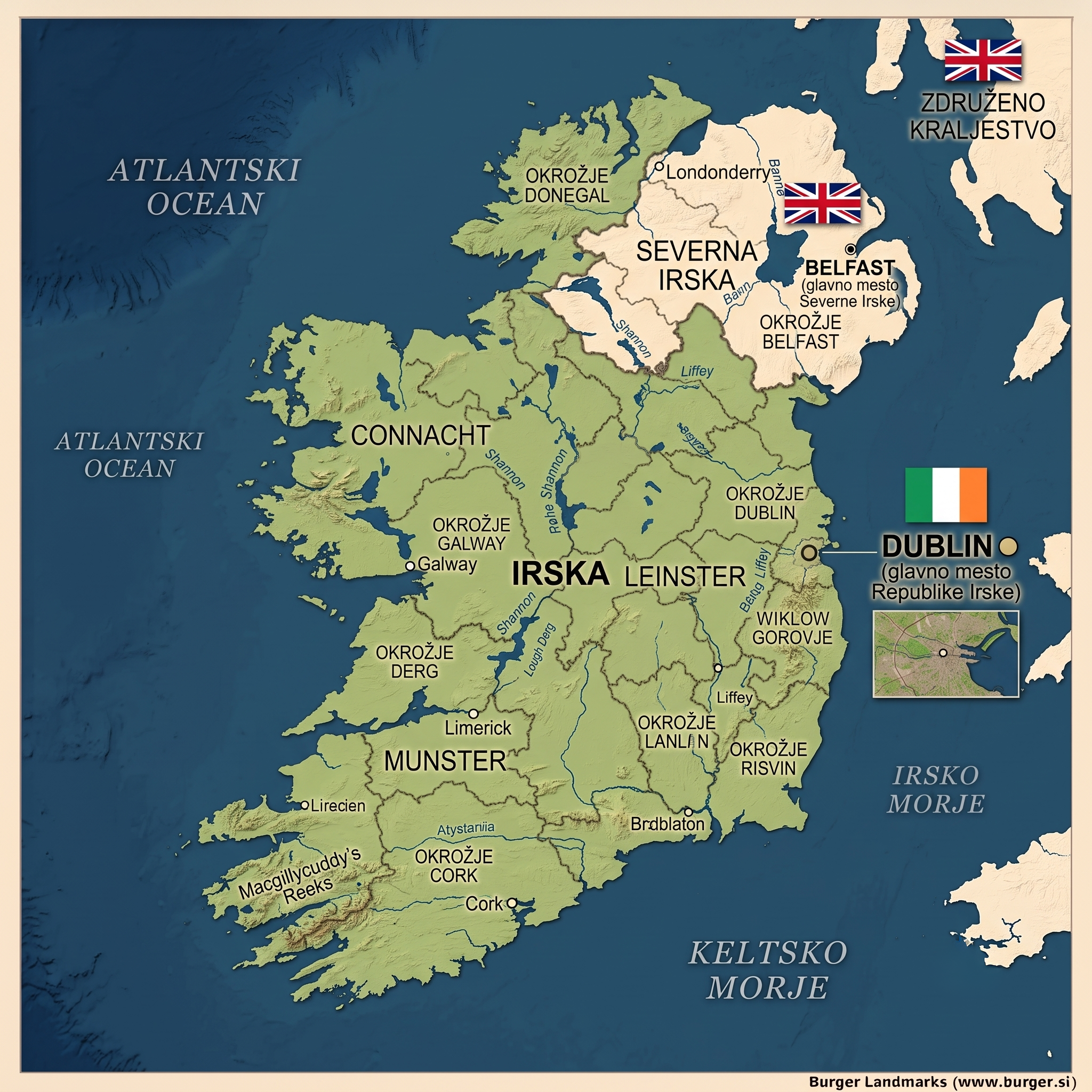
Capital: Dublin
Population: approximately 5.3 million
Total area: 70,273 km²
- Land: 68,883 km²
- Water: 1,390 km²
- Coastline: 1,448 km
- Lowest point: Atlantic Ocean (0 m)
- Highest point: Carrauntoohil – 1,038 m / 1,041 m
UNESCO World Heritage
Nature
- Killarney National Park
- Kerry Way
- Carrauntoohil Horseshoe Loop Trail
- Beara Way
- The Burren
- Killary Fjord
Archaeology
Physical Geography of Ireland
Ireland is an island nation in northwestern Europe, surrounded by the Atlantic Ocean. The Irish Sea separates it from Great Britain. The landscape is dominated by a central lowland plain, encircled by coastal mountains and uplands.
Central Lowlands
Fertile plains with lakes, bogs, and rivers. The longest river is the Shannon, flowing southwards into the Atlantic.
Mountains and Uplands
Coastal ranges include the Macgillycuddy's Reeks in the southwest (highest peak Carrauntoohil, 1,041 m), the Wicklow Mountains in the east, and the Mourne Mountains in the north.
Coastline
The coastline is deeply indented with bays, fjords, and cliffs. Famous examples are the Cliffs of Moher and Killary Fjord.
Climate
Oceanic climate with mild winters, cool summers, high rainfall, and humidity. The Gulf Stream moderates temperatures.
Geology
Predominantly limestone bedrock, with older metamorphic and igneous rocks in the west. Karst features are typical in the Burren region.
Regions of Ireland
Ireland is traditionally divided into four historic provinces, each with strong cultural identity:
- Leinster – eastern province with the capital Dublin; political and economic hub.
- Munster – southwestern province, known for rugged landscapes, bays, and the city of Cork.
- Connacht – western province with a rugged Atlantic coastline, the Aran Islands, and natural highlights such as Connemara.
- Ulster – northern province; most of it belongs to Northern Ireland (UK), while three counties (Donegal, Cavan, Monaghan) are part of the Republic of Ireland.
These provinces are further divided into 26 counties, which remain important cultural and historical units of identity.