
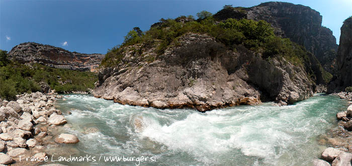

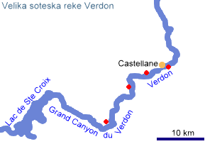
The Verdon Gorge, officially named the Grand Canyon du Verdon, ranks among the most picturesque and geomorphologically most remarkable gorges in Europe. It lies on the southern edge of the Alpes‑de‑Haute‑Provence department, between the small towns of Castellane in the east and Moustiers‑Sainte‑Marie in the west. At its western outlet, the river flows into the large reservoir Lac de Sainte‑Croix, which today represents a central element of water management and tourism in the region.
Geography
The gorge is approximately 21 kilometres long and winds between high limestone plateaus rising several hundred metres above the riverbed. Its deepest sections reach up to 1,500 metres, placing it among the deepest European gorges carved into carbonate rocks. The Verdon River, which originates in the Alps north of Barcelonnette, is a wild alpine river in its upper course, but within the canyon it calms into a narrow, turquoise channel, characteristic of high concentrations of dissolved calcium and microscopic limestone particles.
The southern rim of the gorge is known as the Corniche Sublime, a panoramic road and viewpoint line offering some of the most impressive vistas of vertical cliffs, rock faces, and the deeply incised river channel. The northern rim is more varied, with numerous accessible points and trailheads for hiking routes.
Geology
The gorge is carved into massive limestones and dolomites deposited in a shallow Mesozoic sea around 150 million years ago. Later Alpine tectonic phases uplifted and fractured the carbonate strata, and during the Quaternary period the Verdon River exploited these fractures, gradually deepening its channel.
Erosional processes have shaped an exceptionally diverse relief:
-
vertical cliffs with characteristic fault lines,
-
deep narrows (such as the Imbut),
-
limestone ledges and boulders,
-
karst caves and shafts opening in the canyon walls.
The river’s intense turquoise colour is caused by microscopic limestone particles that refract and scatter light within the water.
Economic Use
Economic activity in the area is closely tied to the river’s hydrological potential. In the 20th century, France launched an extensive hydroelectric project that included the construction of several dams and reservoirs: Castillon, Chaudanne, Sainte‑Croix, Esparron, and Quinson. The Lac de Sainte‑Croix dam (completed in 1974) is the largest among them and today serves as a key source of electricity and flow regulation.
Visible within the gorge are remnants of an ambitious but never completed water‑drainage project: a 14‑kilometre system of tunnels designed to divert water and improve flow control. Today these tunnels form a unique footpath that provides access to some of the most remote parts of the canyon.
In addition to hydroelectricity, the surrounding area plays an important role in local agriculture (particularly the cultivation of lavender, grains, and olives on the surrounding plateaus) and in the service sector, which is strongly linked to tourism.
Tourism
The Verdon Gorge is one of the most significant natural tourist attractions in southern France. Each year it is visited by several hundred thousand people drawn by:
-
hiking: the famous Sentier Blanc‑Martel (partly routed through tunnels), Sentier de l’Imbut, and the Corniche Sublime;
-
climbing: more than a thousand climbing routes in the limestone walls, making it one of the premier climbing destinations in Europe;
-
water sports: kayaking, rafting, and canyoning in the upper river sections;
-
swimming and boating on Lake Sainte‑Croix;
-
scenic drives along panoramic roads on both the northern and southern rims of the canyon.
Tourism is carefully regulated, as the area is part of the Parc naturel régional du Verdon. Special attention is devoted to preserving the sensitive ecosystem, which includes rare birds (such as the griffon vulture), endemic plants, and rich karst biodiversity.
author: Boštjan Burger